- Geography India - Introduction
- Geography India - Physical Aspect
- Geography India - Drainage System
- Geography India - Climate
- Geography India - Natural Vegetation
- Geography India - National Forest
- Geography India - Wildlife
- Geography India - Soil
- Geography India - Land Resources
- Geography India - Agriculture
- Geography India - Mineral Resources
- Geography India - Energy Resources
- Geography India - Industry
- Geography India - Transport
- Geography India - Communication
- Geography India - Foreign Trade
- Geography India - The People
- Geography India - Settlement
- Geography India - Migration
- Regional Development
- Geography India - Disasters
- Geography of the World
- Geography World - Introduction
- Evolution of the Earth
- Geography World - Climate
- Geography World - Transport
- Geography World - Communications
- Geography World - Population
- Human Settlement
- Human Development
- International Trade
- Geography Useful Resources
- Geography - Online Quiz
- Geography - Online Test
- Geography - Quick Guide
- Geography - Useful Resources
- Geography - Discussion
Geography India - Climate
Introduction
Weather is the temporary state of the atmosphere, while climate refers to the average of the weather conditions over a longer period of time.
Weather changes quickly, may be within a day or week, but climate changes in imperceptivity and may be noted after 50, 100 years, or even more.
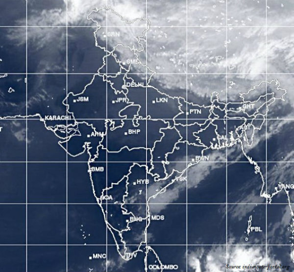
The climate of India has distinct regional variations discernible by the pattern of winds, temperature, and rainfall; further, also in the form of rhythm of seasons and the degree of wetness or dryness.
Factors Influencing Climate
- Major factors that determine the climate of India are −
- Latitude
- The Himalayan Mountains
- Distribution of land and water
- Distance from the sea
- Altitude
- Relief
Winter
During the winter, north of the Himalayas develops a high pressure center.
This high pressure center gives rise to the flow of air at the low level from the north towards the Indian subcontinent (i.e. south of the mountain range).
All of Western and Central Asia remains under the influence of westerly winds (known as Jet Stream) along the altitude of 9-13 km from west to east.
These winds blow across the Asian continent at the latitudes, north of the Himalayas, roughly parallel to the Tibetan highlands.
However, Tibetan highlands act as a barrier in the path of these jet streams, as a result of this, the jet streams get bifurcated into two branches.
One branch is located to the south of the Himalayas, while the second branch is positioned to the north of Tibetan Plateau.
The western cyclonic disturbances, which enter the Indian subcontinent from the west and the northwest during the winter months, originate over the Mediterranean Sea and are brought into India by the westerly jet stream.
Summer
During the Summer, the wind circulation over the subcontinent undergoes a complete reversal at both, the lower as well as at the upper levels.
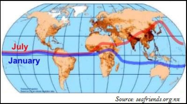
By the middle of July, the low pressure belt nearer the surface [termed as Inter Tropical Convergence Zone (ITCZ)] moves northwards, roughly parallel to the Himalayas between $20^{\circ}N$ and $25^{\circ}N$ (as shown in the image given below).
The ITCZ is a zone of low pressure, attracts inflow of winds from different directions.
With the apparent northward movement of the Sun towards the Tropic of Cancer in March, temperatures start rising in north India, which is the sign of advent of Summer season.
April, May, and June are the months of summer in north India.
In the heart of the ITCZ in the northwest, the dry and hot winds known as Loo, blow in the afternoon, and very often, they continue to well into midnight.
Towards the end of the summer, there are pre-monsoon showers, which are a common phenomenon in Kerala and coastal areas of Karnataka. This phenomenon is locally known as mango showers, as it helps in the early ripening of mangoes.
Monsoon
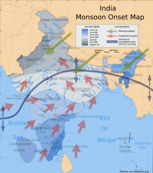
The maritime tropical air mass (mT) from the southern hemisphere crosses the equator and rushes towards the low pressure area; in general, the southwesterly direction.
This moist air current causing rainfall in India is popularly known as the southwest monsoon.
Simultaneously, an easterly jet stream flows over the southern part of the Peninsula in June with a maximum speed of 90 km per hour.
The easterly jet stream steers the tropical depressions into India and these depressions play a significant role in determining the distribution of monsoon rainfall over the Indian subcontinent.
The tracks of these depressions are the areas of the highest rainfall in India.
The southwest monsoon, which is a continuation of the southeast trades, get deflected towards the Indian subcontinent after crossing the Equator.
The easterly jet stream is held responsible for the burst of the monsoon in India.
The southwest monsoon sets first over the Kerala coast by $1^{st}$ of June and then moves swiftly to reach Mumbai and Kolkata between $10^{th}$ and $13^{th}$ June. Further, by mid-July, southwest monsoon engulfs the entire subcontinent.
Southwest monsoon gets divided into two branches − the Arabian Sea, causing rain in western coast of India and the Bay of Bengal branch, causing rain in eastern coast to India.
Generally, the cold weather season sets in by mid-November in northern India.
However, the Peninsular region of India does not have any well-defined cold weather season.
There is hardly any seasonal change in the distribution pattern of the temperature in coastal areas because of the moderating influence of the sea and the proximity to the equator.
Winter monsoons do not cause rainfall, as they move from land to the sea. Hence, primarily, they have little humidity; and secondly, due to anticyclonic circulation on land, the possibility of rainfall from them reduces.
However, in northwestern India, some weak temperate cyclones coming from the Mediterranean Sea (with little moisture) cause rainfall in Punjab, Haryana, Delhi, and western Uttar Pradesh.
On the other hand, during October and November, northeast monsoon while crossing over the Bay of Bengal, picks up moisture and causes torrential rainfall over the Tamil Nadu coast, southern Andhra Pradesh, southeast Karnataka, and southeast Kerala.
Interesting Facts
The shower causing coffee flowers blossom in Kerala and nearby areas is known as blossom shower.
Nor Westers are the dreaded evening thunderstorms in Bengal and Assam.
During the south-west monsoon, the period after having rains for a few days, if rain fails to occur for one or more weeks, it is known as break in the monsoon.
The notorious nature of Nor Westers can be understood from the local nomenclature of Kalbaisakhi, meaning a calamity of the month of Baisakh.
In Assam, Nor Westers are known as Bardoli Chheerha.
Hot, dry, and oppressing winds blowing in the Northern plains from Punjab to Bihar are known as Loo.
The rain in the southwest monsoon season begins rather abruptly.
Sudden onset of the moisture-laden winds associated with violent thunder and lightning, is often termed as the break or burst of the monsoon.
Tamil Nadu coast remains dry during the monsoon season because it is situated parallel to the Bay of Bengal branch of southwest monsoon.
The monsoon rainfall has a declining trend with increasing distance from the sea. For example, Kolkata receives 119 cm, Patna 105 cm, Allahabad 76 cm, and Delhi 56 cm.
The months of October and November are known as retreating monsoons season.
The advent of south-west monsoon is known as advancing monsoon.
As the south-west monsoon passes over the ocean surface (Indian Ocean, Arabian Sea, and Bay of Bengal) it picks up moisture and causes rainfall in India.
Windward side of Western Ghats receives heavy rainfall (more than 250 cm); however, as the distance increases from the sea, the amount and intensity of rainfall start decreasing.
The Bay of Bengal branch of monsoon advances towards the eastern part of India and causes heavy rainfall. North-east India receives heavy rainfall during the monsoon season.
Cherapunji and Mawsynram (two places of Meghalaya) are worlds wettest place.
Though there are great spatial variations in India; the average annual rainfall of India is 125 cm.
The whole of India has a monsoon type of climate, but because of the regional variations, there are various types of climate in India.
Koeppens Climate Classification
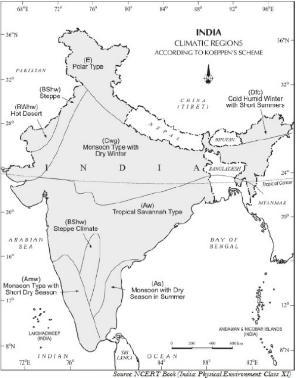
Koeppen, based on his scheme of Climatic classification on monthly values of temperature and precipitation, identified five major climatic types. They are −
Tropical climates
Dry climates
Warm temperate climates
Cool temperate climates
Ice climates
However, the following map (shown below) illustrates the major climatic types of India as classified by Koeppen.
