
Article Categories
- All Categories
-
 Data Structure
-
 Networking
-
 RDBMS
RDBMS
-
 Operating System
-
 Java
Java
-
 MS Excel
-
 iOS
iOS
-
 HTML
HTML
-
 CSS
CSS
-
 Android
-
 Python
-
 C Programming
-
 C++
C++
-
 C#
C#
-
 MongoDB
-
 MySQL
MySQL
-
 Javascript
-
 PHP
PHP
-
 Economics & Finance
Selected Reading
Spatial Databases
Spatial data is associated with geographic locations such as cities,towns etc. A spatial database is optimized to store and query data representing objects. These are the objects which are defined in a geometric space.
Characteristics of Spatial Database
A spatial database system has the following characteristics
- It is a database system
- It offers spatial data types (SDTs) in its data model and query language.
- It supports spatial data types in its implementation, providing at least spatial indexing and efficient algorithms for spatial join.
Example
A road map is a visualization of geographic information. A road map is a 2-dimensional object which contains points, lines, and polygons that can represent cities, roads, and political boundaries such as states or provinces.
In general, spatial data can be of two types −
- Vector data: This data is represented as discrete points, lines and polygons
- Rastor data: This data is represented as a matrix of square cells.
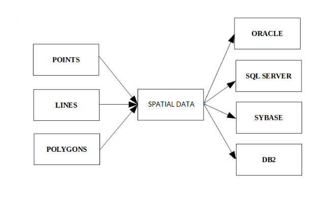
The spatial data in the form of points, lines, polygons etc. is used by many different databases as shown above.

Updated on: 2020-06-19T11:35:00+05:30
24K+ Views

Advertisements